This post relates to an ancient Indian habitation site, in the Little Blair Valley area of ABDSP. For more than a thousand years, the Kumeyaay (ku-may-eye) Indians used this spot on a seasonal basis. Each year, as the weather turned cold, they would migrate down from their summer villages, in the Cuyamaca and Laguna Mountains. The park openly admits to the existence of this place, but it is infrequently visited because of it's location. We were in the Little Blair Valley all day and didn't see a single person (besides each other). Of course, it was 106-F there today.
Another day, another road in the middle of nowhere. Actually this road was in pretty good shape, but there were areas of deep sand. It would be very easy to get stuck here.
The hike up the trail on the left was a short one, but well worth the time.
Very rough country.
It doesn't take long before you start seeing evidence of a former village. The right side of the large stone in front, has four mortars on it and the left side of the has many cupules. They may look like small mortars, but they are actually considered the earliest form of Rock Art.
A closer look at the rock. Note the cupules in the upper left part of the photo.
There are also several cupules on the vertical surface of this large rock.
A little further up the trail was this large boulder.
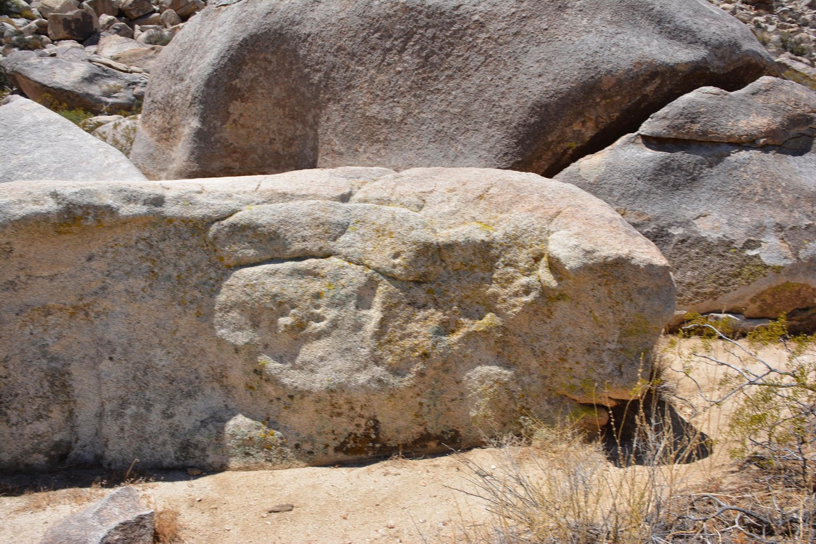
Next to the large boulder is this large rock with many cupules on it. If you look at it from the right angle, it looks like a huge fish (maybe a grouper). The largest cupule looks like the fish's eye.
On the back side of the boulder there are some pictographs.
Enhanced a bit with DStretch. If you look in the upper right hand corner, you can see that there were two black symbols. The one on the left, is all but invisible now (see previous photo).
This boulder is about thirty feet tall. You can see that the two pieces were attached at one time.
On the other side of the boulder, there are morteros (mortars) on an adjacent rock.
 Another mortero. I was also excited about the ice cold water in the jug my wife was carrying.
And another
And so on...
Sorry, I never get tired of them. EVERY time I see a mortar, or any other type of grinding or milling stone. I see (in my mind's eye) female members of the tribe, preparing food. They are also probably making small talk about the events of the day.
Once past the village site, the trail deteriorates into no trail at all.
The trail is on the right side. Next to the trail is Cholla Cactus. Cholla Cactus is also called "jumping cactus." Cholla Cactus is NOT your friend.
Near the end of the canyon stands this large boulder.
Once closer to the boulder, a dark black pictograph is visible.
Here is a close up of the symbols. I couldn't find any information on them, but I know that black is the "male" color and the top and bottom symbols appear to be anthropomorphic males. I could be mistaken, but I believe human anatomy was one of the few classes I passed.
On our way back down the trail, there is a rock shelter. There are a few cupules inside, but not much else.
The desert is usually a quite and peaceful place. Not so much, on this trip. This little beauty is a Cicada. I'm sure some of you know much more about them than I do. All I know, is they don't live very long, only show up every once in a while and are VERY loud.
I took this photo once we got back to the trail head. We were camped on top of the most distant mountain, just to the left of the tall Agave stalk. The Indians roasted and ate the agave. More on that subject in a future post.
.