American Indians have lived and traveled through this part of southwestern Arizona for more than 10,000 years. This was primarily made possible because of the Gila River. It flowed freely and fully until about 150 years ago. That was when damming and constant water diversion reduced it to a trickle. Prior to that, the banks of the Gila acted as a "freeway" for ancient Indians. Most of the water may be gone, but the Indians certainly left their mark (literally) on the landscape. This petroglyph site is one of many along the Gila River. Without the river, I doubt there would have been any.
After a long drive across the desert from Yuma, we eventually arrived at our destination.
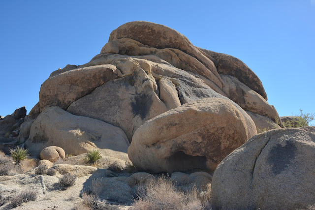
This photo was taken from the other side of the rock formation. The ground in the near part of the photo is called "Desert Pavement." It really is as flat and hard as a road, and is a natural occurrence.
A little closer to this hill of granite and basalt rocks. From this distance you start to see hundreds, if not thousands of petroglyphs.
The petroglyphs are primarily of two different styles. The first style is "Western archaic" and were created from approximately 2000 to 8000 years ago. They are mostly geometric in shape. In the middle of the above photo the "grid" shaped symbol is an example.
The "rake-like" symbol on the rock in this photo is also an example.
The "ladder" looking symbol near the top of this photo is yet another. Just to the right of the "ladder" and and little above it, is a petroglyph representing a scorpion. This is of a different style from a later period.
The second style in the area is called the "Gila Style." Symbols of this style were thought to have been created between 300 BC and 1450 AD, by the Hohokam people. These symbols reflect people, animals, plants, and circular shapes. Some common shapes such as zig-zags were thought be have been used by both groups.
In most places a rock with this many symbols, over such a long period of time, are referred to as "newspaper rock." However, I haven't heard that about this rock. I guess it was a popular place to leave a symbol, because they were made right on top of each other. There are deer, lizards, people, turtles, spirals, etc.
This is the same rock, but pulled back a bit. You can also clearly see petroglyphs from both styles (and time frames) on the same rock to the right.
This view is pretty interesting for a couple of reasons. First off, you can clearly see that some of the petroglyphs on the top rock are buried in the ground. Nobody really knows how much the ground level changed over thousands of years, but it clearly has changed. The second thing is the "metate" (aka "slick" or "grinding stone").
Here is another metate, this one has a cupule, or small mortar in it. It is a very rare occurrence to see a grinding surface on the same stone that also contains petroglyphs.
I hate seeing graffiti in these places, but sometimes historic graffiti is a good thing. Many other people (non-Indian) later used the ancient Indian trails to travel across the lower southwest for various reasons. Some of these people are famous and you would recognize their names and stories. Fodder for another post, so I won't get into it. I have no idea who SMC 1815 and Max. G 1857 were yet, but I'm going to try and find out!
TDQ 1878 and VA 1907 were also here. Pretty rude of them to leave their names on the same rock with the petroglyphs. Of course, back then nobody placed any value on them.

