Showing posts with label Cahuilla. Show all posts

Monday, July 30, 2018

JTNP - Lost Horse Valley Area - Petroglyphs 1

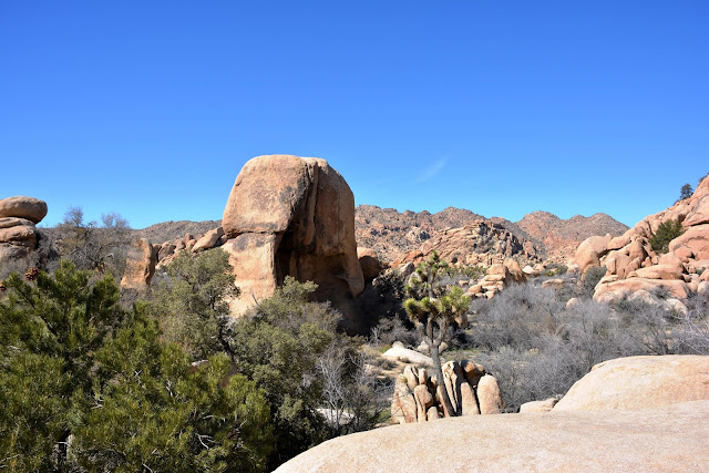
Although this post is about a small and obscure petroglyph site, most of the photos relate to the scenery instead. 

The general area is called Lost Horse Valley. I'll pipe down now, hope you enjoy the rest of the photos.


It's not much of a petroglyph panel, but I love it just the same.


.

Monday, July 2, 2018

Bernasconi Pass Petroglyph and Luiseno Creation Story

This very interesting petroglyph sits in Bernasconi Pass in Riverside County. It has not been dated, but Indians have been in this area for thousands of years.  Luiseno creation lore says that the symbols on this rock represents Tukmit (the first man) and Tomayowit (the first woman). When the hollow part on top of the rock fills with water, it flows from one depression into another representing the male, and then into the lower representing the female. Then it flows through the female symbol to the ground. This is how the people, the land, the plants, and animals were created. 

Following creation, their first born children were sent to the four corners of the of the earth. Tomayowit lay down and become the Earth Mother. Tukmit rose above it all to become Father Sky. 


Although information relating to most petroglyphs no longer exits, it is fantastic that we still have sites like this one. This spot is included in a no trespassing zone adjacent to a dam, and I was fortunate to be allowed to see it. The stone was moved down the pass to this spot about 60 years ago to save it from seemingly ever present bulldozers.

The back side gives no clues. 

 A view of the symbols.

 I used DStretch only to highlight the symbols. You can more clearly see the path of the water passing from the male through the female symbol (yoni).


A little scenery

-----------------------------------------------------------------------------
There may or may not have been more petroglyphs further up the pass. If there was, they might have been destroyed when the road and dam were built. 


.

Monday, March 26, 2018

Queen Valley Area Pictographs - Joshua Tree National Park

Sadly, the pictographs at this site are virtually invisible to the naked eye. It is also sad that very few of the multitude of visitors to the park have ever seen, or even heard of it.

The pictographs themselves are rather unremarkable, but the site is still amazing because of the rock formations in the area.


Backside

Backside

Front side. 


This large boulder is about 30' tall. Very impressive in person. It looks smaller in this photo because of the Joshua tree that was between me and the rock.


One of a few rock shelters in the area.

A natural water "tank" used by the local Indians that was later enlarged by local ranchers.


I had to crank up the contrast to even see a hint of the pictographs.


DStretch to the rescue. 


I have more posts from other "disappearing" sites that I'm going to try and work in here.

.


.

Monday, February 19, 2018

Twin Tanks #3 Wilderness Area Pictographs & Rock Shelter JTNP

The third of four posts from the Twin Tanks area of Joshua Tree National Park. I use the term "Twin Tanks area" loosely because it's closer to it than anything else, but it's not really close at all. If you are thinking about trying to find these two sites, please remember that the first few photos may, or  may not even be in the area at all. It is also very easy to become hurt, or lost there.


Pictograph Site
The "cave" in that huge boulder looks pretty inviting!


Can you spot the pictographs in this photo?

The same photo after some post processing. This isn't a large or amazing site, and it is extremely obscure. I'm sure there are very few people who have seen it since it's creation. If anybody does stumble upon it, I doubt if they would see anything at all.


Nothing at all in this photo, right?


It wasn't easy to coax these two guys out of the first photo. It looks like two people to me. You can still see the outstretched arms, head, and body of the one on the left. I might be wrong about the one on the right, it may be just a smudge! Heck, I may be wrong about the one on the left also...


Rock Shelter


There were small pottery shards nearby, and also evidence (almost invisible) of pictographs in this rock shelter. Even after using DStretch on them there were only a few faint lines. Because of that I didn't include any photos. 


.

Monday, October 23, 2017

Twin Tanks Post #2 Wilderness Area - Joshua Tree National Park

This is the long overdue Part 2 of 3 posts relating to the greater Twin Tanks area in JTNP. If you are so inclined, here is a link to Part 1. The following photos are examples of the spectacular sights to be seen in this area. As I said in post 1, this area is very rugged, and great care should be taken while there. Even very experience hikers (such as my friend Peter) at "Spare Parts and Pics" can hurt themselves here. Right Peter? Click on the link to see Pete's sprained ankle, and other beautiful photos.

This one is posted first, for no other reason that I love it. Take a bite!

I was headed that-a-way! Except for the first 50 yards or so, it is very rugged...

 ...and looks like this. Looking back to where I started.


A happy little rock creature is slithering towards us 


A bear?

Very remote grinding slick

Nearby pestle (or mano). I couldn't find any other rocks made of this type of material in the area.

Pottery shards!

------------------------------------------------------------

Twin Tanks Area Post 3, will contain some petroglyphs, pictographs, and maybe even a habitation site!