Showing posts with label metates. Show all posts

Monday, February 5, 2018

Painted Rock Petroglyph Site - Gila River area AZ

American Indians have lived and traveled through this part of southwestern Arizona for more than 10,000 years. This was primarily made possible because of the Gila River. It flowed freely and fully until about 150 years ago. That was when damming and constant water diversion reduced it to a trickle. Prior to that, the banks of the Gila acted as a "freeway" for ancient Indians. Most of the water may be gone, but the Indians certainly left their mark (literally) on the landscape. This petroglyph site is one of many along the Gila River. Without the river, I doubt there would have been any.

After a long drive across the desert from Yuma, we eventually arrived at our destination.

 This photo was taken from the other side of the rock formation. The ground in the near part of the photo is called "Desert Pavement." It really is as flat and hard as a road, and is a natural occurrence.

 A little closer to this hill of granite and basalt rocks. From this distance you start to see hundreds, if not thousands of petroglyphs.

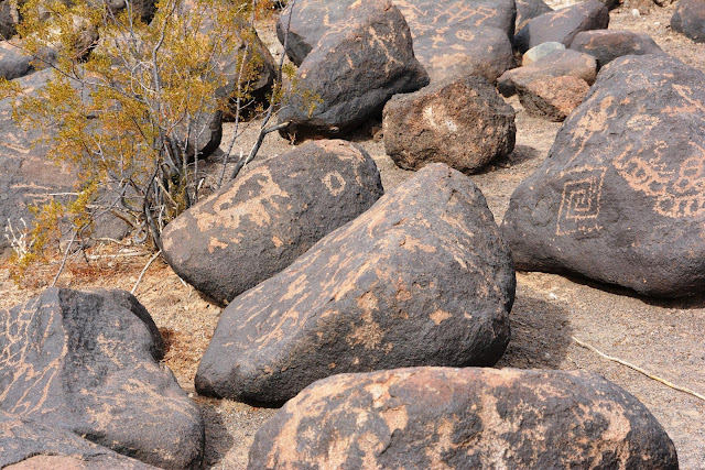
The petroglyphs are primarily of two different styles. The first style is "Western archaic" and were created from approximately 2000 to 8000 years ago. They are mostly geometric in shape. In the middle of the above photo the "grid" shaped symbol is an example.

 The "rake-like" symbol on the rock in this photo is also an example.

The "ladder" looking symbol near the top of this photo is yet another. Just to the right of the "ladder" and and little above it, is a petroglyph representing a scorpion. This is of a different style from a later period.

The second style in the area is called the "Gila Style." Symbols of this style were thought to have been created between 300 BC and 1450 AD, by the Hohokam people. These symbols reflect people, animals, plants, and circular shapes. Some common shapes such as zig-zags were thought be have been used by both groups.


In most places a rock with this many symbols, over such a long period of time, are referred to as "newspaper rock." However, I haven't heard that about this rock. I guess it was a popular place to leave a symbol, because they were made right on top of each other.  There are deer, lizards, people, turtles, spirals, etc.

This is the same rock, but pulled back a bit. You can also clearly see petroglyphs from both styles (and time frames) on the same rock to the right.


This view is pretty interesting for a couple of reasons. First off, you can clearly see that some of the petroglyphs on the top rock are buried in the ground. Nobody really knows how much the ground level changed over thousands of years, but it clearly has changed. The second thing is the "metate" (aka "slick" or "grinding stone").

Here is another metate, this one has a cupule, or small mortar in it. It is a very rare occurrence to see a grinding surface on the same stone that also contains petroglyphs.

I hate seeing graffiti in these places, but sometimes historic graffiti is a good thing. Many other people (non-Indian) later used the ancient Indian trails to travel across the lower southwest for various reasons. Some of these people are famous and you would recognize their names and stories. Fodder for another post, so I won't get into it.  I have no idea who SMC 1815 and Max. G 1857 were yet, but I'm going to try and find out!

TDQ 1878 and VA 1907 were also here. Pretty rude of them to leave their names on the same rock with the petroglyphs. Of course, back then nobody placed any value on them.


Monday, April 10, 2017

Another Amazing Unknown Pictograph Site - Joshua Tree National Park

I've never heard so much as a peep about this site. It is obscure to the point that it isn't even a secret.
It also contains some symbols that I've never seen anywhere else.

This is not in the same area as the pictos in this post. I just liked the photo and needed to work it in somewhere.

There are a lot of boulders that look similar to this one in the area. After sticking my head in several of them, bingo!

It was partially hollow. 

 The other side of the boulder.

 A new symbol to me. Something to do with females and fertility, me thinks. 

Two layers of pictographs. The first and third symbol are solid, while the second and fourth are totally hollow, including the vertical parts. All four of them are attached to a horizontal bar on top.  I wonder if this is related to the Red Diamond chains hanging from the horizontal bar in the next photo?

The four symbols in the previous photo, and the three diamond chains in this one, are representative of "female." So maybe both are part of a female puberty initiate ceremony. If you do follow this LINK, it will take to my post relating to that subject, and this photo. If you don't, no problem...


 This spot clearly had old pictos in it.

After DStretch


A third panel in the hollow boulder


.

Monday, March 27, 2017

Unknown Pictograph and Habitation Site - Joshua Tree National Park

This post is not about one of the "secret rock art sites" in Joshua Tree N.P. It's about a virtually unknown rock art site in Joshua Tree N.P. I have to give credit to someone for telling me about this place. Please see his info, at the end of this post.

In case somebody reading this wants to find it, be advised that the landscape photos in this post are not anywhere near the site. I'd like to keep this place as obscure and pristine as it is now.

This photo was taken along one of the well know trails in JT. It is not related to these pictographs 

 Neither is this one

Nor this one

Ditto here

After a long hike, and a lot of climbing in, around, and over boulders, we arrived.  My eyes lit up when I saw two milling slicks hidden in a spot that would be very hard to find. If you don't already know, a "slick," is also known as a "metate," or "grinding surface." Together, they are used to grind acorns, nuts, grains, plants, etc.

The rock has two well used surfaces on it. You see one of them just to the left of middle. As smooth as a baby's behind (as my granny always used to say), That stone wasn't sitting on the slick when I got there. I found it sitting on the ground just a foot or so away.  That rock is called a "Mano" or "hand"(para aquellos de ustedes que no hablan espanol). 😉 The presence of the mano at this site is a really big deal.

Unfortunately, it is broken. I started looking around for the other half. I don't know if this it, but it might be. It is either half of this one, or half of another, Because both were very smooth. I wasn't about to start digging around to find out. I didn't leave them on the rock, and I also didn't put them exactly where I found them. I'd hate for them to be taken by the next person who sees them. I hid them!

 Very close by was this rock shelter. 

Always happy to see the faint remains of pictographs. Note the lines in the upper left corner. I don't think I've seen any violet or purple pictographs in this area (that I can remember anyway).

 A little processing of the photo with DStretch reveals the pictographs

 You can see the grid like symbol much better in this one

 Another little hint of red in this photo

 Even after processing the photo, this still isn't very clear. 

 Another symbol (in the center)

 Look what else showed up!

The sunburst is very cool in it's own right, but look in the middle of it. Another sunburst!   I have never seen that before. The center usually is empty, or solid, or has a "dot" in the middle.
---------------------------------------------
Without the help of my friend Robert, I probably would have never found, or even known about this place. Robert is a professional photographer and has also published several books about rock climbing. You can see his photography here, or here. You can see and/or purchase his books at Amazon.


,


.

Monday, March 7, 2016

Part #2 - Every Long Hike Should Pay Off Like This One Did

In my last post, I only showed you the stars of the show. This post includes the rest of what I saw. When you put it all together, it adds up to an amazing and mind blowing experience. One of the most thrilling things about it was, the total and absolute absence of human footprints.


This two inch granite "point" (arrowhead or spear) was sitting on the ground in clear view. I placed it on a pottery sherd/shard to get some contrast. You can clearly see marks on it, that were left when it was transformed from a rock, into a tool. I put the pottery shard back on the ground where I got it, but the point was put where somebody just hiking by couldn't see it. Then, I kicked some dirt over it. Like I've said many times before, out here it's an awesome bit of history, but taken out of that location, it's nothing but an interesting rock in your sock drawer. Maybe even worse, it could become one of thousands of other points in a bag or box, locked in the back room of some NPS, NFS, or BLM office.


Another rock shelter and another spirit stick

I can't tell you the exact purpose of this, but it was clearly arranged by somebody a long time ago.


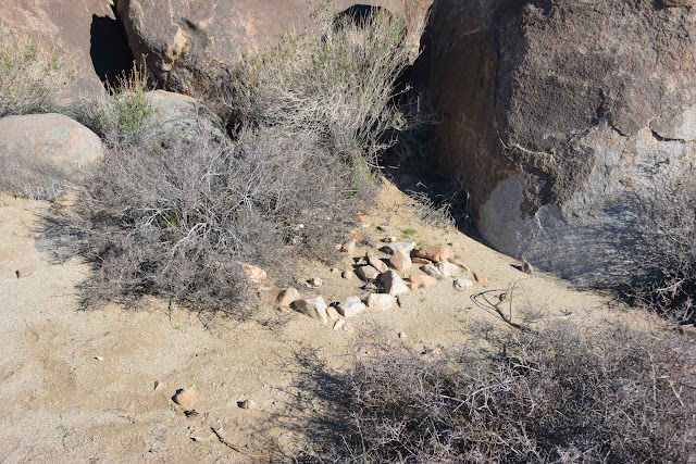
Another man-made rock arrangement. If the bush wasn't there, you could more easily see that it is, or was a circle.


The Ocotillo were very green and healthy looking


A shard that was once part of the lip, on of a piece of pottery

Shards were all over the place. 


This large boulder had a couple of spots that have been worn smooth by grinding seeds, or other food items with a handheld rock (Mano). These spots are usually called slicks, metates, or a milling stations. 


A little later we saw another one, that still had a Mano sitting on it.


Both the bottom of the Mano and the little concave portion of the large rock were worn smooth. I'm not saying that this Mano has been sitting there for hundreds of years, but maybe it was! To see the smooth spots on the large rocks is fairly common, to find the Mano, even just in the area, is very rare.


Just because I liked it

The obligatory black and white. This was a large desert tortoise.  


A couple of what I believe are called scutes. They cover the tortoise shell.

If you stood on a higher level, you could more easily see that this arrangement of rocks is in the shape of an arrow. It looks to be a little messed with, but it is clearly an arrow pointing through the notch in between those large rocks. I wonder what it is pointing at. Next trip...


Yoni
Maybe some of you remember that a Yoni, is a female hoo-hoo, fashioned out of a natural crack in a rock. If you look at the bottom of it, you can see the tool marks. The tools were made of harder stone. These are fairly common in the southwest.


I think this large boulder looks like a Desert Big Horn Sheep head (sort of).


Desert Bluebell

Always nice to see the moon in the middle of the day. I think it completed the photo. Of course it might just have been a smudge of chicken salad on my lens.

And of course, there were also some petroglyphs nearby.


.