Showing posts with label road trip. Show all posts

Monday, November 30, 2015

Chloride Arizona Ghost Town - Back Streets

In my last post, I was ranting against some of the "cheesy" things that are presented in some ghost towns. In truth, the places that hold staged "gun fights" are really not quite ghost towns yet. There are people still living and working in these places. I also said that my next article would be related to what I love about them. If you get off the main street, you will see that they are very much alive. Alive, with history, interesting people that are only found in the desert, and an amazing mix of creativity and art.  Chloride is one of these towns.


The Back Streets of Chloride Arizona


Bowling balls


Industrial whimsy


Scales?

Not necessarily historical, but I love the old RV. 


Cowboy boots as yard art


Many of the homes on these streets have some kind of display, either along the road, or in their yard


At first glance, it may just look like a bunch of rocks and junk. Upon closer examination, there are some really cool items and displays in there. A cross between folk and yard art.


This house has some bottle trees. Some bottles were old and some were a bit newer. 


Certainly not art, but pretty odd that these two boats were just sitting there. This is pure high desert and there is no place in the area to use them.


Stuff...


Motorcycle parts


More stuff

New house and sculpture


----------------------------------------------------
Some folks might not like this stuff at all. To me, it is quirky, whimsical, and very creative. There is a lot more, but I wanted to keep this post reasonably short.


.

Monday, March 24, 2014

The Drive Home - Photo Mix

These are random drive-by photos taken on our last trip. Not from the jeep this time, but from our RV (mostly on our drive home). I'm very happy that my wife loves to drive and splits the time with me. I took some of these while I was the passenger and some while I was driving. It's pretty easy to tell the difference. Anyway, no real theme today. I have a ton of posts in draft form; mines, ghost towns, rock art sites, trails, scenery, stories, etc., but I really like to do posts like this once in a while.

This is Newman. As you can see, he really hates it in our RV and just can't seem to relax. I know what you're thinking, "Gee Pat, that is one fat cat!"  He could stand to lose a couple of pounds (who among us is any different?), but even the vet says he is really healthy. Healthy, hungry and humongous! Newman carries his weight well. He is just a HUGE cat! That is a large dinette he has taken over. Four people can sit there comfortably. He is so big that when he is standing up, he can see on our dining room table (at home). He is the size of a medium dog. In fact, he acts like a dog. He wags his tail like a dog and it thwacks against things. He growls like a dog. He's a gentle giant and we love traveling with him. Okay, let's get on with the drive-by photos.

What is wrong with this scene? I assume you've noticed the semi-truck and trailer driving right at us. It's not like he's supposed to be in the other lane, this highway is two lanes in each direction! The desert is starting to bloom like crazy and that was intended subject of the photo.  I don't remember a head-on collision, but I have had a headache for a few days...

The last time we drove by this 40-foot trailer, it was sitting right side up, with advertisements on the side. It gets a bit windy in the Mojave.

 It's for sale, if anybody is interested...

Not now, not back in the day, not ever...  

With all that room, I never understood why people settle so close to the highway.

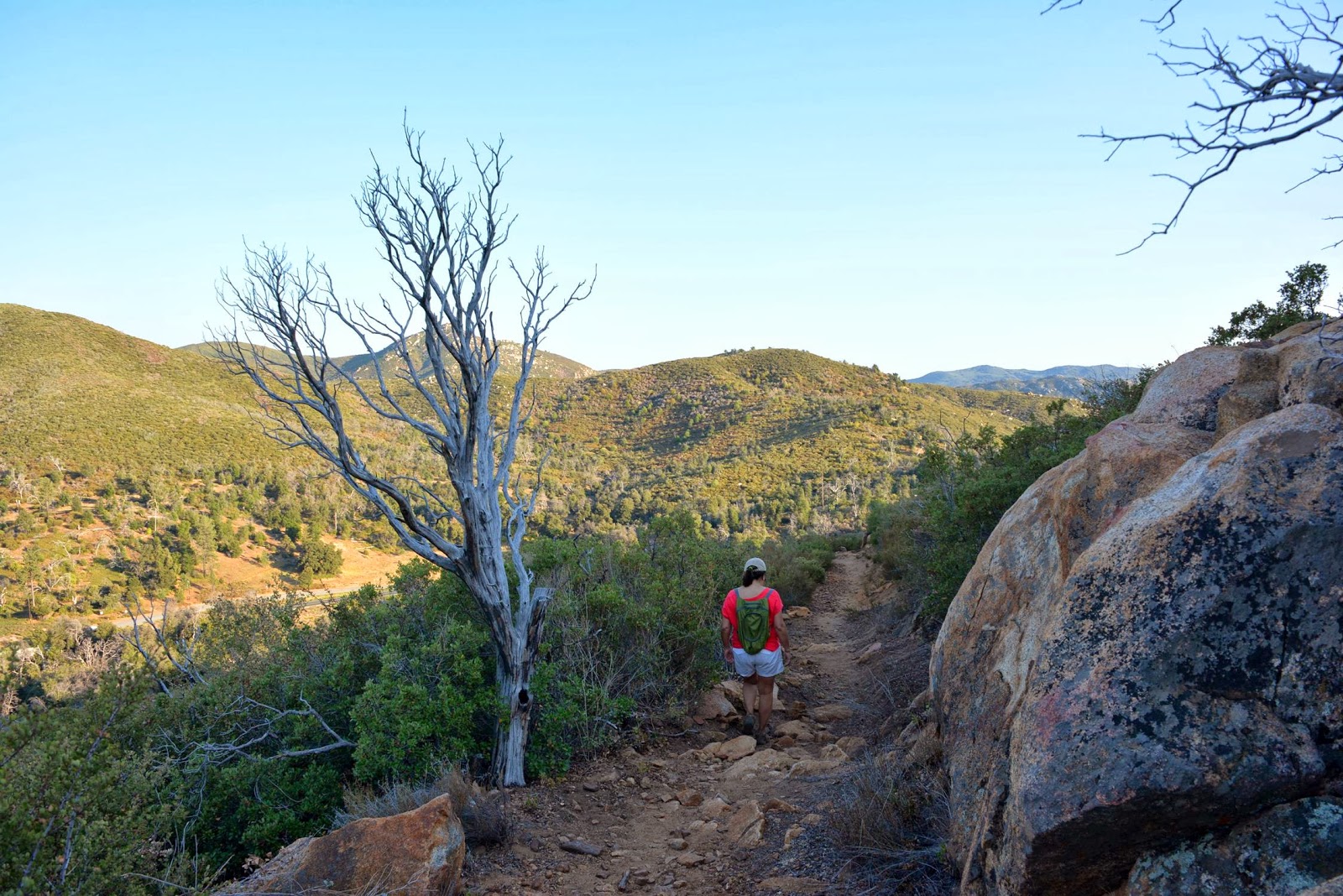
 To me, this scenery is just as beautiful as the mountains or coast. 

Why does there always seem to be a train visible in the desert? I'll tell you! The train routes were here long before any roads were. When the federal government started building highways, they took advantage of the route planning that the railroads had already done. They always take the easiest and flattest route possible.


 Sometimes they play chicken! 

Now, I'll shut my face and let you enjoy the Mojave


 No train here, but I loved the sky. The wind blowing in two different directions.


My favorite


Monday, November 4, 2013

Ryan Ranch - Joshua Tree National Park

As some of you may already know, Joshua Tree is pure desert. Water of any type is very valuable. In the late 1800's Jepp and Tom Ryan homesteaded this site to obtain the rights to a natural spring that used to be located there. The water was used to support the Lost Horse Mine (subject of a future post), which was owned by Jepp, Tom, their brother Matt and a local prospector named Johnny Lang. Water was pumped from the spring to the mine, that was over 3 miles away. In addition to supporting mining activities, the Ryan family also raised cattle. At one time there was over 50 people living on the ranch. 


The main ranch house was very much intact until 1978. That year an arsonist set fire to it. The adobe walls and foundation are all that remains.


The ranch house commanded a fantastic view. 


See the rock formation to the left of the tree? The large rectangular stone jutting into the sky above the rest is called "Headstone." It's a very well known rock climbing site. Joshua Tree has hundreds, if not thousands of them...


The walls of the ranch house were made from bricks and adobe. Both of which were made from local materials, including tailings from the mine. Years later they discovered that the mine tailings still contained gold. From that point forward they referred to the place as the "gold brick house."


 Heading up the hill to the spring and pump house.

 The remains of the old windmill.

Looking past the spring and pump towards the ranch house. I was standing near the base of what is now called "Ryan Mountain."


The amazing rock formation behind the ranch house. There is a lot of evidence around there relating to a long period of Indian presence in the area. 


 The remains of the original ranch bunk house.

We just returned from two weeks in the Joshua Tree area. The first five days it was closed because of the federal government shutdown. I can probably do about 10 posts on this amazing place. I'll probably cut it down a bit, but I love it and there is so much to see and do. In addition, I have a lot of personal history in the area. I might even tell a true story about something amazing that happened to me and a friend there when we were about 12 years old. 


.

Monday, October 28, 2013

Memorial Peak Trail

On 12/7/1922, a plane carrying US Army Colonel, Francis Marshall, took off from North Island airbase, in San Diego Harbor for an inspection of army posts in  Arizona. The De Havilland DH-4B, Bi-Plane was piloted by Lt. Colonel Charles Webber. The plane took off in poor weather and didn't make it very far. It crashed near Japacha peak in the Cuyamaca Mountains. Despite the largest military search effort ever (up to that time), the wreck site was not found.  Six months later a local rancher discovered the wreck while rounding up stray cattle. The next year a very small memorial that included the plane engine, was built on the crash site. The airplane was left there for almost 40 years before most of it was removed.

The elevation of the mountain side memorial is 4,800 feet. The trail was steep and it was very hot that day. We made a couple of discoveries on the way up that helped keep us going.

Just a bit overgrown in places. Long pants and sleeves will help you avoid a lot of scratches. Of course we didn't have on either.

My wife leading the way uphill 


 A bit of scenery from the hike

 Maybe the prettiest rock I've ever seen!

A huge remnant of the massive Cedar fire that devastate a large portion of San Diego County and burnt almost 100% of Cuyamaca Rancho State Park. The Cedar fire was the largest fire in modern California history.  Prior to that fire (2003) this was a fairly heavily forested area. You can tell by the photos, that it is that it is recovering, but is nowhere near the way it was.


 Awesome Stonewall Peak 

 High country meadow

 Long ways to go and happy for the shade

 10 year old dead trees everywhere


 Almost there!

 Not near the top, but I like the view


I saw a bit of light shining through the brush and powered my way though to see what it was. What it was (and is) is a couple of morteros. For those who don't know, a mortero or "mortar" was created and used by the local Indians to grind acorns or grain into flour.  It takes many years to make them this deep. The local Kumeyaa Indians spent summers in these mountains and winters in the desert lowlands. This went on for centuries.


Multiple and deep morteros means they were probably used for a very long period of time. So, there are probably other indications of their presence in the area. It could be rock art, artifacts, etc. I'm not sure if this rock has anything on it, but it kind of looks like it to me. There is software that enhances those things and I really need to get it.


Finally, we got to the memorial. It's pretty much just the engine and a little plaque. There are also a few parts laying around. There are bees living in the engine.


Some other parts of the plane are just sitting there. I'm SO VERY happy that  people are finally starting to leave things as they find them. That way others can also enjoy!  Thank goodness ATV's and Quad-Runners couldn't make it up the trail.  I do think that some people on those things are responsible for most of the damage, graffiti, vandalism and theft in historic natural places. That's right, I went there!


For no reason other than I liked the symmetry of the dead trees