Showing posts with label Luiseno. Show all posts

Monday, July 2, 2018

Bernasconi Pass Petroglyph and Luiseno Creation Story

This very interesting petroglyph sits in Bernasconi Pass in Riverside County. It has not been dated, but Indians have been in this area for thousands of years.  Luiseno creation lore says that the symbols on this rock represents Tukmit (the first man) and Tomayowit (the first woman). When the hollow part on top of the rock fills with water, it flows from one depression into another representing the male, and then into the lower representing the female. Then it flows through the female symbol to the ground. This is how the people, the land, the plants, and animals were created. 

Following creation, their first born children were sent to the four corners of the of the earth. Tomayowit lay down and become the Earth Mother. Tukmit rose above it all to become Father Sky. 


Although information relating to most petroglyphs no longer exits, it is fantastic that we still have sites like this one. This spot is included in a no trespassing zone adjacent to a dam, and I was fortunate to be allowed to see it. The stone was moved down the pass to this spot about 60 years ago to save it from seemingly ever present bulldozers.

The back side gives no clues. 

 A view of the symbols.

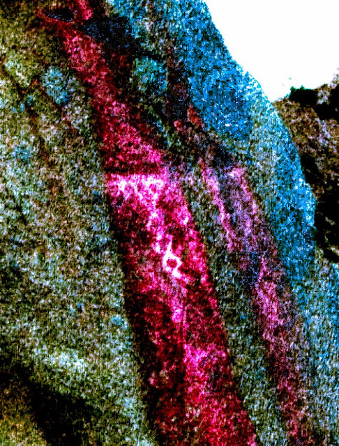
 I used DStretch only to highlight the symbols. You can more clearly see the path of the water passing from the male through the female symbol (yoni).


A little scenery

-----------------------------------------------------------------------------
There may or may not have been more petroglyphs further up the pass. If there was, they might have been destroyed when the road and dam were built. 


.

Thursday, February 23, 2017

Mockingbird Canyon Rock Art

Mockingbird Canyon is a former Luiseno habitation site in Riverside County. The site contains pictographs, a "yoni" (that I didn't see), several morteros, and a "Shaman's Cave. It also has a solstice component. Unfortunately, it was unprotected for decades, and every idiot in the area with a can of spray paint seems to have left their mark there.

A nice boulder pile near the site.

Much of this site is overgrown with plants that you wouldn't want to walk through wearing shorts. Of course, I was wearing shorts. The scabs should be gone in a few more days. On the other side of these rocks...

were these mortars.

There was supposed to be some pictographs very close to the mortars. I found nothing that stood out, and thought they might have totally deteriorated.

When I got home, I enlarged my photos looking for any traces of the pictographs. In the vertical orange streaks, I saw a couple of tiny red lines.

When I used DStretch to enhance the colors, some pictographs were revealed. Maybe some of you will recognize (from several prior posts here) the diamond shaped chains, that are part of female puberty initiate rites. If you have the time or inclination, go Here and Here and Here.


There are also several more mortars along this pretty stream, that is adjacent to the village site. I searched several boulder jumbles on the other side, but found nothing of note.

Back on this side of the stream, this rock seemed a likely spot for some pictographs.

Except for the fact that it was covered with graffiti. I HATE that people do this. The penalty should be much harsher than it is now (which is almost nothing).

I used DStretch and all available color variations to try to find something.

Look just to the right of the vertical red streak in the middle. It sure caught my eye!

Ta-Dah! Those are definitely pictographs (in the middle). Red vertical and horizontal shapes  falling down to a horizontal design. A little lower, you can see some "zig-zag" shapes in red.

The little spot of blue in the middle, is the "Solstice" component. Apparently, during one of the equinox events that take place every year, light shines through that hole and onto a particular spot or symbol. When that happens, it marks the beginning of change in season.

Below the opening, is the "Shaman's Cave." That is where the good stuff is.

It was quickly apparent, that this wasn't the actual opening, but I could still see some white pictographs on the roof.


This "DStretch" enhanced photo came out pretty good, considering my long lens. I climbed back down, and walked around to the other side to see what I hoped was the actual entrance into the cave.

This (and the  next four photos)  are the ceiling above the actual opening and cave. 


When I finally got to these fantastic pictographs. I couldn't get far enough away from them, to take anything but photos of small areas. I believe that this is a solstice site. However, when I look at the designs in the last two photos,  I see fish, and I see fish nets!

On the top of this big flat rock, I thought I saw petroglyphs. Nope! Graffiti!


Tuesday, November 17, 2015

The Hemet Maze Stone


They say you have to start a story with the end in mind. That has no bearing on this post at all, but I thought it would be cool to say it. Sorry...

The petroglyph (yes, just one) we were going to see is about 1/2 of a mile up this road. It is a very important piece of prehistory. Not because of what it means, because we have no idea what it means. We are going because it is EXTREMELY unusual. I guess all of this is lost on my wife, because she is lollygagging walking up the hill and taking photos of every little thing that catches her attention. Don't worry, she probably won't even see this post.

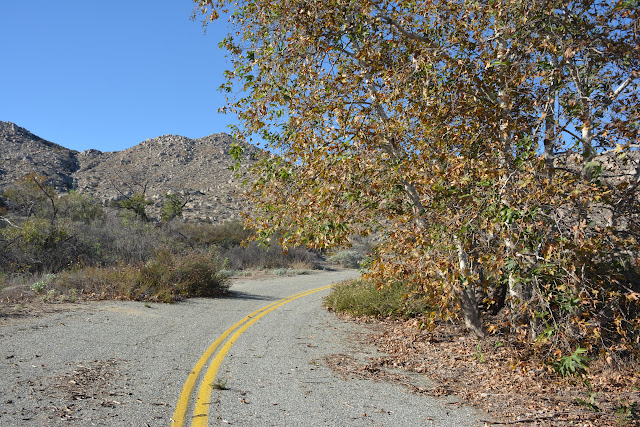
This was a well used back county road at one time. However, it runs very close to the amazing petroglyph we are walking up this hill to see. Rather than subject the site to the traffic and unavoidable vandalism, they CLOSED the road. A simple and effective way to protect the site; the fewer people that see it, the safer it is. Sometimes though, the opposite is true.

This has nothing to do with the post, but doesn't that boulder in the center look like the head of an eel? It even has a black eye.

Based on all the fencing around those rocks, that must be the place.

Yep! 

Not just one fence but two! One of them is even topped with barbed wire. 

So hard to get a good photo without the fence screwing it up. 

Finally, I my wife climbed up the fence enough to get a good photo. You can now see why they call it the Hemet Maze Stone. Maze, because it's a maze, and Hemet Maze, because it is outside of the town of Hemet. The one and ONLY bit of vandalism is visible in this photo. It's hard to see, but in the lower left hand corner, somebody scratched in a swastika. If I had a drone, you'd get a better view of what I'm talking about.

 As you can see, this is an amazing piece of work. It is clearly a"maze"ing.

Doesn't this rock look like some kind of a sea mammal, covering it's ears with both flippers?

Here is some actual (but maybe not so accurate) information on the Maze Stone
People much smarter than me, have weighed in with their opinions relating to what this maze actually is, and when it was created. Some of those opinions area:

  • It was created by shipwrecked Buddhist missionaries.
  • It was created 15,000 years ago, by the "Cascadians" who were thought to be Mayan ancestors.
  • The most balanced opinion, places the creation of the maze, at about 2000 years ago. 
  • I (not unlike the really smart people) have no idea what-so-ever...
There are many other "maze" stones in the American southwest (and very few anywhere else), and this one seems to be the most intricate. I think it would be pretty cool if it was created by ancient Buddhists or Cascadians, but it was most likely the Cahuilla, or Luiseno tribes who deserve the credit. 


.


Monday, July 7, 2014

Alister's Cave Rock Art - Joshua Tree National Park

First off, Alister's Cave isn't actually a cave, it's an alcove, under an overhang, on the side of a cliff. It's probably one of the more well known "secret" rock art sites in the park. Having said that, the number of people who have either seen it, or heard about it, is minuscule. Most of the people who do know about it, are rock climbers and they pretty much ignore it. I'm happy to report, that there appears to be zero vandalism done to the site over the many decades that I've known about it. The main problem with the site is the degradation of the pictographs due to weathering and the natural decomposition of the granite surface. There are also a few faint petroglyphs on a portion of the floor. 


please embiggen this one
This photo and the next, may or may not be in the same area as Alister's Cave. 


Nothing to do with rock art, but it is in the area and is a beautiful example of a California Barrel Cactus


An alcove under an overhang on the side of a cliff. It's pretty tough sledding through all the boulders and vegetation snarls to get to a climbable spot. This isn't that spot...

As you can see, the pictographs are very faint. That is very unfortunate because there are a ton of them here in many layers. 


An enhanced (via DStretch) version of the photo above. Still not too good.


Another example of how faded most of the pictos are

Enhanced version of the previous photo

As viewed by me

Enhanced 

As viewed

Enhanced by DStretch. I recognize a few of them. There is a Yoni or atlatl in the upper right hand corner. There also appears to be a flying saucer in the middle of the photo. Nah!


A closer photo of the flying saucer looking symbol


Some visible black pictographs 

Enhanced version. At the top center, there appears to be a anthropomorphic symbol. The symbols that look like brooms are likely representing rain. 


This panel is pretty much invisible to the naked eye

Thanks to DStretch, we can at least see what is left of the pictos in that spot

Once again, very hard to see. It does look like there are some very faded reddish, white and black symbols.

This enhanced version of the previous photo, reflects exactly why DStretch is so amazing...  The large white image to the upper left is clearly anthropomorphic (human, or human like). The red symbol in the center might be an atlatl (spear or arrow thrower). The appearance of an atlatl indicates that at least some of these symbols are VERY old, because the atlatl was used to "throw" arrows, darts and spears before the appearance of the "bow" in this part of the country.


In the next two photos, you will be able to see, that there are old pictographs drawn over older pictographs. 

Enhancement #1 is concentrated on the dark pigments

Enhancement #2 is concentrated on the red pigments. Old on top of old, on top of older.


.