Showing posts with label Rock Shelter. Show all posts

Monday, March 26, 2018

Queen Valley Area Pictographs - Joshua Tree National Park

Sadly, the pictographs at this site are virtually invisible to the naked eye. It is also sad that very few of the multitude of visitors to the park have ever seen, or even heard of it.

The pictographs themselves are rather unremarkable, but the site is still amazing because of the rock formations in the area.


Backside

Backside

Front side. 


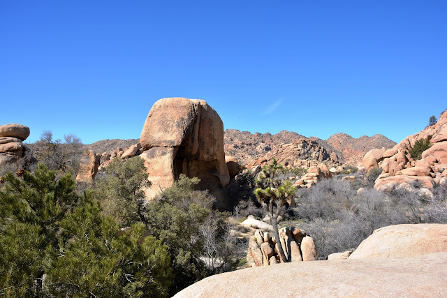
This large boulder is about 30' tall. Very impressive in person. It looks smaller in this photo because of the Joshua tree that was between me and the rock.


One of a few rock shelters in the area.

A natural water "tank" used by the local Indians that was later enlarged by local ranchers.


I had to crank up the contrast to even see a hint of the pictographs.


DStretch to the rescue. 


I have more posts from other "disappearing" sites that I'm going to try and work in here.

.


.

Monday, February 19, 2018

Twin Tanks #3 Wilderness Area Pictographs & Rock Shelter JTNP

The third of four posts from the Twin Tanks area of Joshua Tree National Park. I use the term "Twin Tanks area" loosely because it's closer to it than anything else, but it's not really close at all. If you are thinking about trying to find these two sites, please remember that the first few photos may, or  may not even be in the area at all. It is also very easy to become hurt, or lost there.


Pictograph Site
The "cave" in that huge boulder looks pretty inviting!


Can you spot the pictographs in this photo?

The same photo after some post processing. This isn't a large or amazing site, and it is extremely obscure. I'm sure there are very few people who have seen it since it's creation. If anybody does stumble upon it, I doubt if they would see anything at all.


Nothing at all in this photo, right?


It wasn't easy to coax these two guys out of the first photo. It looks like two people to me. You can still see the outstretched arms, head, and body of the one on the left. I might be wrong about the one on the right, it may be just a smudge! Heck, I may be wrong about the one on the left also...


Rock Shelter


There were small pottery shards nearby, and also evidence (almost invisible) of pictographs in this rock shelter. Even after using DStretch on them there were only a few faint lines. Because of that I didn't include any photos. 


.

Monday, July 31, 2017

Porcupine Wash Petroglyphs - JTNP

The Pinto Basin is about 250 square miles of what most people would refer to as barren and desolate desert. The main park road skirts the edge of it, but rarely does a car stop for anything more than a quick glimpse around. At first glance, you would think it to be a very formidable wilderness. You wouldn't be wrong in the slightest bit. Especially so, during the summer months. This is the hottest and driest area in the park, and those conditions have cost people their lives. I believe three in the past year alone.

The basin is outlined in red. The three surrounding mountain ranges are also desolate. It's hard to believe now, but this area was once lush, swampy, and even had water flowing through it. Clearly, that was a long time ago.

In almost all cases in the desert, where there was water, there was also people. It was no different here. They didn't leave a lot of evidence, but they did leave some! We'll get to that in a minute. First, a few pics of the beautiful (in my eyes) scenery.

embiggen this one


Now to the petroglyphs. We were traveling down Porcupine Wash (still in Pinto Basin), keeping this rock jumble on our right. Our destination is that dark rock (that looks like Pac-Man) just to the left of center.

 Close

 Closer

 There! If you saw my last post, you will see that the petroglyphs on this rock very much resemble the ones included there. These are in much better condition. In additions to the barbells, please note the faint "sunburst" image near the brush on the right side of the photo.

 There was also a nearby rock shelter. There was soot on the overhanging rock to the right. I don't know when this spot was last used, but I'm pretty sure it was a long long time ago.

 My favorite find of the day was this fossilized shell. I believe it's a freshwater snail (fossil) I was amazed that it was still intact. I moved it into a safer spot and hope it survives for a lot longer.


 In the middle of this photo, you can see my wife exploring.

 I believe this rock material is called Hornblende. 


 It wasn't easy getting into the middle of this jumble of rocks, but there I am.

Yours truly...

-----------------------------------------------
Mammal fossils relating back to the stone age have been found in the Pinto Basin. Also, traces of very early human presence.


Monday, March 27, 2017

Unknown Pictograph and Habitation Site - Joshua Tree National Park

This post is not about one of the "secret rock art sites" in Joshua Tree N.P. It's about a virtually unknown rock art site in Joshua Tree N.P. I have to give credit to someone for telling me about this place. Please see his info, at the end of this post.

In case somebody reading this wants to find it, be advised that the landscape photos in this post are not anywhere near the site. I'd like to keep this place as obscure and pristine as it is now.

This photo was taken along one of the well know trails in JT. It is not related to these pictographs 

 Neither is this one

Nor this one

Ditto here

After a long hike, and a lot of climbing in, around, and over boulders, we arrived.  My eyes lit up when I saw two milling slicks hidden in a spot that would be very hard to find. If you don't already know, a "slick," is also known as a "metate," or "grinding surface." Together, they are used to grind acorns, nuts, grains, plants, etc.

The rock has two well used surfaces on it. You see one of them just to the left of middle. As smooth as a baby's behind (as my granny always used to say), That stone wasn't sitting on the slick when I got there. I found it sitting on the ground just a foot or so away.  That rock is called a "Mano" or "hand"(para aquellos de ustedes que no hablan espanol). 😉 The presence of the mano at this site is a really big deal.

Unfortunately, it is broken. I started looking around for the other half. I don't know if this it, but it might be. It is either half of this one, or half of another, Because both were very smooth. I wasn't about to start digging around to find out. I didn't leave them on the rock, and I also didn't put them exactly where I found them. I'd hate for them to be taken by the next person who sees them. I hid them!

 Very close by was this rock shelter. 

Always happy to see the faint remains of pictographs. Note the lines in the upper left corner. I don't think I've seen any violet or purple pictographs in this area (that I can remember anyway).

 A little processing of the photo with DStretch reveals the pictographs

 You can see the grid like symbol much better in this one

 Another little hint of red in this photo

 Even after processing the photo, this still isn't very clear. 

 Another symbol (in the center)

 Look what else showed up!

The sunburst is very cool in it's own right, but look in the middle of it. Another sunburst!   I have never seen that before. The center usually is empty, or solid, or has a "dot" in the middle.
---------------------------------------------
Without the help of my friend Robert, I probably would have never found, or even known about this place. Robert is a professional photographer and has also published several books about rock climbing. You can see his photography here, or here. You can see and/or purchase his books at Amazon.


,


.